Hoher Fricken (1984m)
Estergebierge

| Details | |
|---|---|
| Ascent: | 3:30 h |
| Descent: | 3:00 h |
| Elevation: | 1270 m vert. |
| Distance: | 13,0 km |
| Season: | End of May - November. |
| Weather Forecast: | 1) wetter.com, 2) DAV-Bergwetter |
Character: of medium difficulty. The ascent is partly very steep and requires experience (i.e.Trittsicherheit). An additional highlight of this tour are the Kuhfluchtwasserfälle.
Video Description: YouTube
Drive to base: To Farchant; direction Bahnhofsstraße, then onto Mühldörflstraße. At the end of the road take a left to Kuhfluchtweg. Follow the road to the parking area.
Approach: Approach is possible from Farchant (i.e. Ortsteil Mühldorf) or you could take the Wank-lift to the Wank and hike down to the Esterbergalm.
Hike: From Farchant/Mühldorf follow a steep trail through the forrest to the Esterbergalm. Follow the direction to Frickenkarl. Follow the wide ridge to the summit.
Logbook:
Hike 09.07.2020 - Hoher Fricken & Bischof
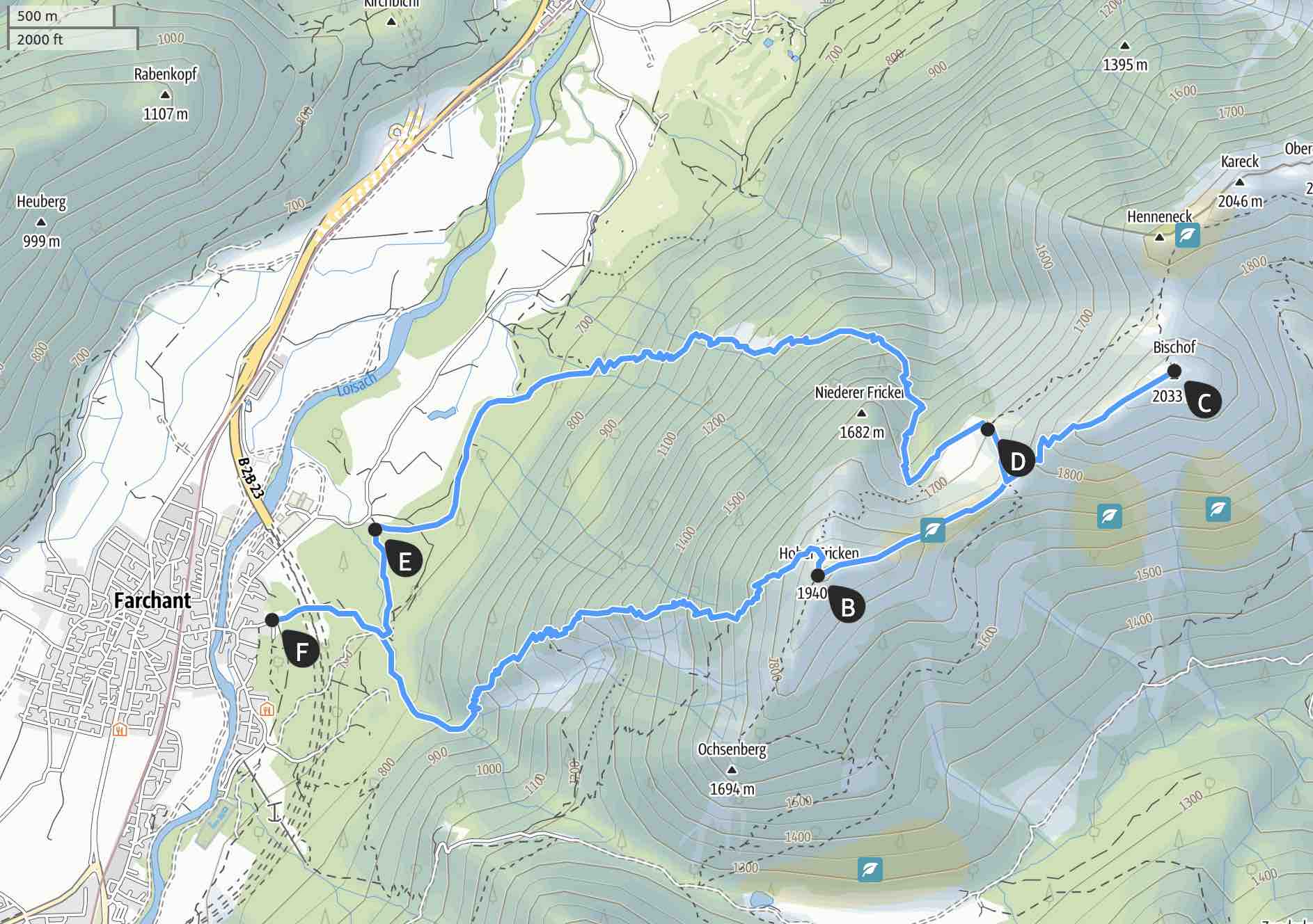
Route: Farchant - Kuhflucht - Hoher Fricken - Bischof - Oberausteig - Farchant
Map & Route Summary: 1)Hoher-Fricken-pdf or 2) online at alpenvereinaktiv
Description:
- I parked at the Kuhflucht parking area at the end fo the ‘Kuhfluchtweg’ in Farchant, Ortsteil Mühldorf. Address for Car navigation is Farchant, Kuhfluchtweg.
- I started hiking at 9:00am.
- It was a very hot day. Luckily the majority of the ascent is in the forest and therefore in the shade. Nevertheless when I reached the Latschen (i.e. alpine pine bushes), it got really hot, as the bushes keep the heat and reflect it.
- It was quiet and a lonely hike. Not many hike from Farchant the very steep trail up to the Hoher Fricken. (You can alternatively take the Wank-Bahn and hike from the Wank summit on a ridge path to the Hoher Fricken).
- From the parking area I walked in the direction of the ‘Kuhfluchtwasserfälle’. Then I followed the ‘Königsweg’. I reached and crossed a bridge an a trail starts and goes very steeply up through the forest.
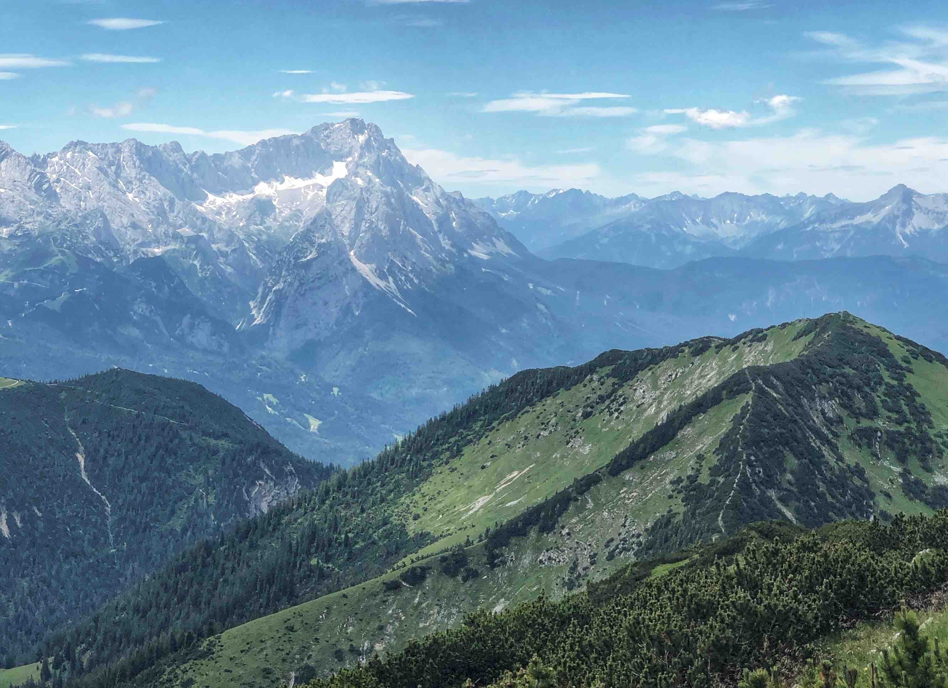
- The trail is indeed very steep and I gained a lot of attitude meters in short time. The view to the Wettersteiggebirge and Alpspitze and Zugspitze is fantastic.
- The steep trail rewards you with a great view.
- I reached the summit of the Hoher Fricken at 11:40am.
- So, the ascent took me 2h 40mins.
- After a break and a sandwich I started to hike down from the Fricken-summit to the east in the direction of the Bischof-summit. I followed a nice and easy ridge trail. At the lowest point of the saddle are signs showing the way to the Bischof and to the Oberauer-Steig. (This is the steig I will take down later).
- I followed the sign to the Bischof and it started to go uphill again. Its still a nice and not too difficult path up to the Bischof.
- I reached the Bischof Summit at 12:50 am.
- From there you have a beautiful view back to the Hoher Fricken, Wank, and the Wetterstein. In the other direction, north-east, you can see the other summits the Estergebirge, e.g. Henpeck, Kareck, oberer Rißkopf, and Krottenkopf.
- After a short break I hiked back down again. 1) you have the option to decent the Bischof from the same way I cam up, reach the saddle again between Bischof and Fricken and follow the sign down via Oberauer-Steig. That’s the way I took. 2) Alternativly, you can hike down the very steep Northside of the Bischof. So you hike down on loose stones and gravel until you reach a fork. You don’t take the right path that leads to the Weilheimer Hütte. Instead you go left, west, in the direction of the Fricken. When you reach the Oberauer-Steig take the path down.
- The Oberauer-Steig is recommended as the path down, as this trail is not quite as steep as the trail we took up.
- Around 16:00 I was back down at the parking area.
- Because it was such a hot day, I cooled my feet in the Loisach. Highly recommend.
-
The hike is very steep an requires endurance. However, the steep trail rewards with a fantastic view from the summit.
- In total I hiked from 9:00am to 16:00 with 5:15h walking time. Distance: 16.25km. Total elevation: 1.504m. Highest point: 2.031m. Lowest Point: 587m
