Kreuzspitze (2185m)
Ammergauer Alpen

| Details | |
|---|---|
| Type: | Mountaineering route (T3+) and short climbing section (I) |
| Ascent: | 3:00 h - 3:30 h |
| Descent: | 2:00 h - 2:30 h |
| Elevation: | 1100 m vert. |
| Distance: | - |
| Season: | Summer - only in dry season and good conditions |
| Notes: | Don’t go in the rain! or when weather is unclear. The tour is mostly on loose grounds. Can be slippery! |
| Danger: | Alpine Environment with Alpine Dangers. Loose ground. Often very exposed |
| Weather Forecast: | 1)wetter.com, 2) DAV-Bergwetter |
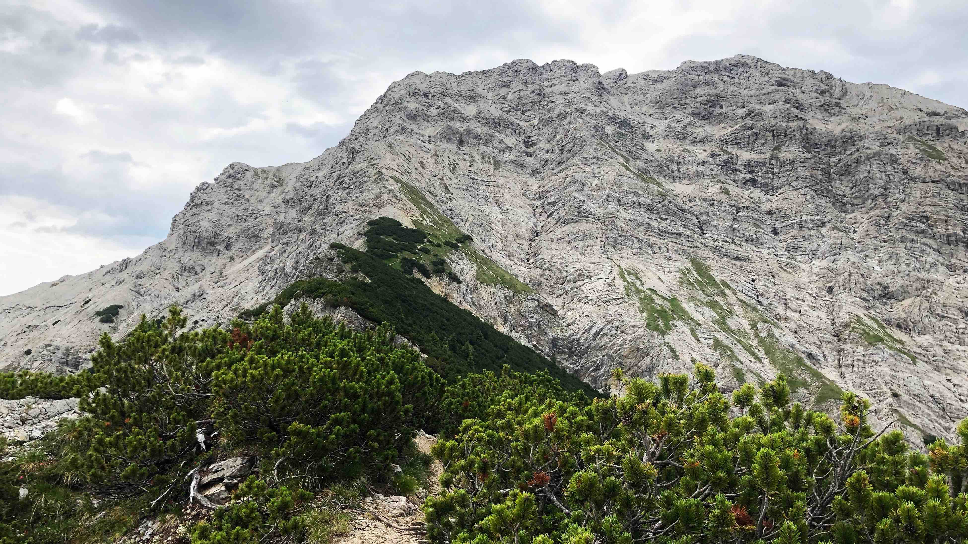
The Kreuzspitze (2185m) is the highest summit in the Ammergauer Alpen. It is a nice alpine hike that shouldn’t be underestimated. This majestic mountain offers steep trails, lots of loose ground, rocks, climbing bits, and a wonderful view.
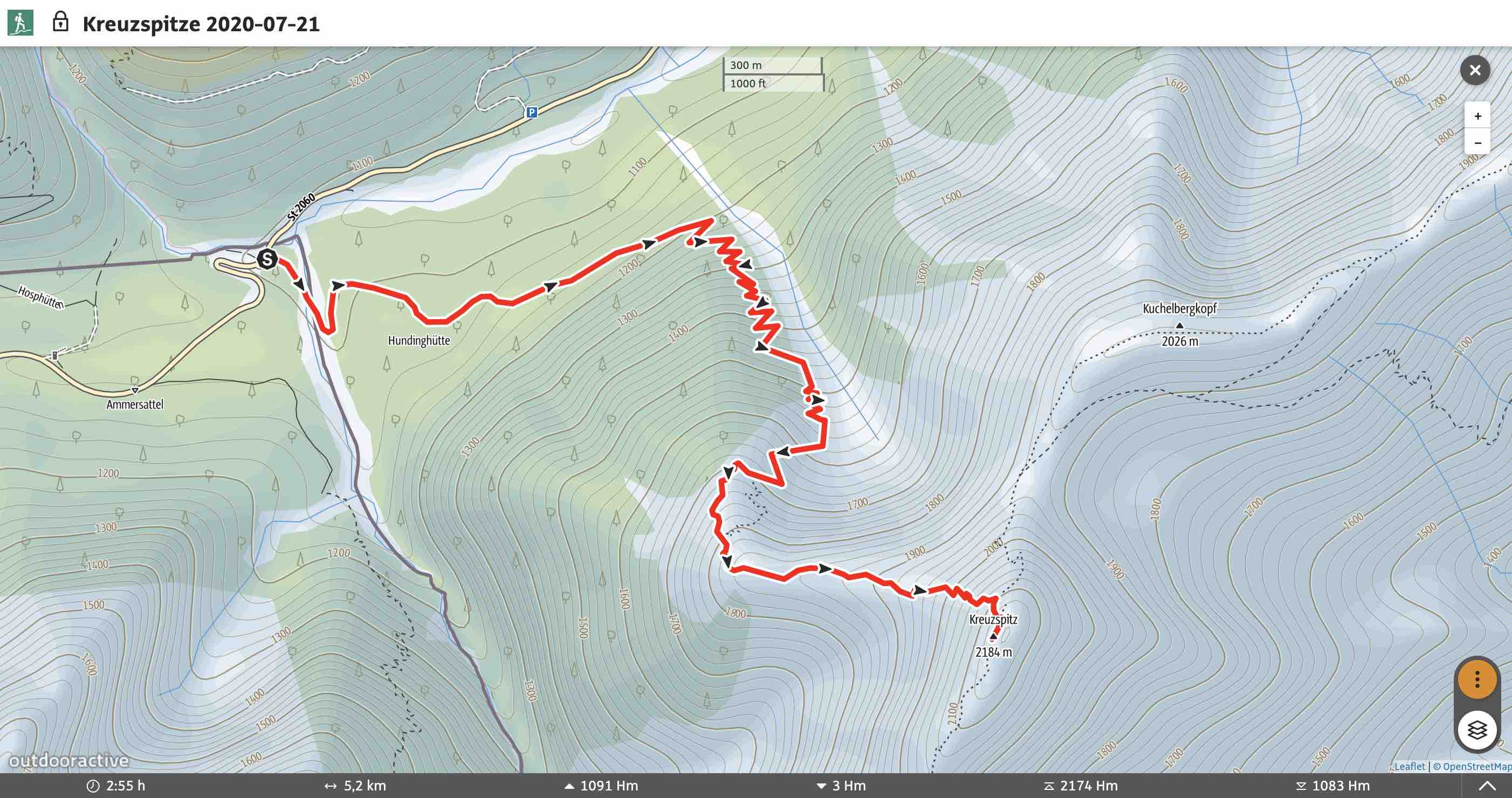
Map & Route Summary: online at alpenvereinaktiv
Video Description: YouTube
Route: Parkplatz Ammerwald (1080m) – Corss Riverbed, left hand side – Hochgrießkar – Kreuzspitze (2185m) – Descent same as Ascent
Character: The Kreuzspitze is an alpine mountaineering route of medium-high difficulty (T3+) and requires short parts of climbing in the (I) degree. This tour requires alpine experience and a good head for heights.
Drive to base: Address for car navigation: drive to Linderhof, 82488 Ettal, but then you need to stay on the road, direction Plansee. 7km behind linderhof, just behind the boarder, is a parking area on the left side. Park here. Yellow sign directs to Klammspitze.
Hike:
- Park at Parkplatz Ammerwald (1080m) which lies on the left side of the road, approx. 7km behind Linderhof, and just behind the boarder.
- From the parking area follow the yellow sign to the Kreuzspitze. First cross the Riverbed (i.e. Gries) and find the trail on the left side of the Riverbed. A trail starts to lead into the forest.
- The first part in the forest is nice and not too steep.
- After not very long the path gets steeper and we hike up the forest in lots serpentines.
- Then you will reached the Hochgrießkar and the winding trail leads up the cirque (i.e.Kar) and it gets steeper and stony. Always follow the red dots and markings to stay on the trail.
- The paths leads out of the cirque into the mountain pine bushes (i.e. Latschenkiefer).
- Then you will see the cross of the Kreuzspitze in fornt of you.
- Follow the path which is very narrow, exposed, and often stony. Be careful of loose ground.
- From here a ridge leads to the summit rock of the Kreuzspitze.
- The last bit requires climbing (I) and scrmabling to the to of the summit. Then a short, exposed, ridge path to the summit.
Descent: The normal route for the descent is the same as the ascent.
Huts/Stations: None.
Logbook:
Hike 21.07.2020 - Kreuzspitze (2185m)
Route: Parking area on the left side of the road 7km behind Linderhofi.e. Parkplatz Ammerwald (1080m) – über das Gries, Links – Hochgrießkar – Kreuzspitze (2185m) - Hochgrießkar - Gries - Parkplatz Ammerwald (1080m)
Description:
- I parked at Parkplatz Ammerwald (1080m) which lies on the left side of the road, approx. 7km behind Linderhof, and just behind the boarder.
- I started hiking at 9:10am.
- From the parking area I followed the yellow sign to the Kreuzspitze. First I crossed the Riverbed (i.e. Gries) and find the trail on the left side of the Riverbed. A trail starts to lead into the forest.
- The first part in the forest is nice and not too steep.
- After not very long the path gets steeper and we hike up the forest in lots serpentines.
- Then I reached the Hochgrießkar and the winding trail leads up the cirque (i.e.Kar) and it gets steeper and stony. Always follow the red dots and markings to stay on the trail.
- The paths leads out of the cirque into the mountain pine bushes (i.e. Latschenkiefer).
- Now I was able to see the cross of the Kreuzspitze and on the other side I had a great view.
- I followed the path that is very narrow, exposed, and often stony. I used my hands to keep my balance and prevent slipping away. Loose ground.
- From here a ridge leads to the summit rock of the Kreuzspitze.
-
I reached the summit rock from which a climb/scramble would lead up to the summit. However, due to bad weather I had to turn around and hurry back down.
-
In total I hiked from 9:15am to 1:00pm,(however, I didn’t make it all the way up and had to turn around). Distance: 12.33km. Total elevation gain: 880hm. Highest point: 1977 m. Lowest Point: 1081 m.
- In the future I would go here only with mountain boots (dt. Festen Bergschuhen). Moreover, the tour requires perfect weather conditions. If wet, and rain fall this exposed and slippery route can very dangers!
