Friederspitz (2049m) & Frieder (2053m)
Ammergauer Alpen

| Details | |
|---|---|
| Type: | Easy but long mountain hike |
| Ascent: | 3:30 h |
| Descent: | 3:00 h |
| Elevation: | 1200 hm to Friederspitz; traverse to Frieder adds 200 hm |
| Distance: | 19km |
| Season: | End of May - Early October |
| Weather Forecast: | 1)wetter.com, 2) DAV-Bergwetter |
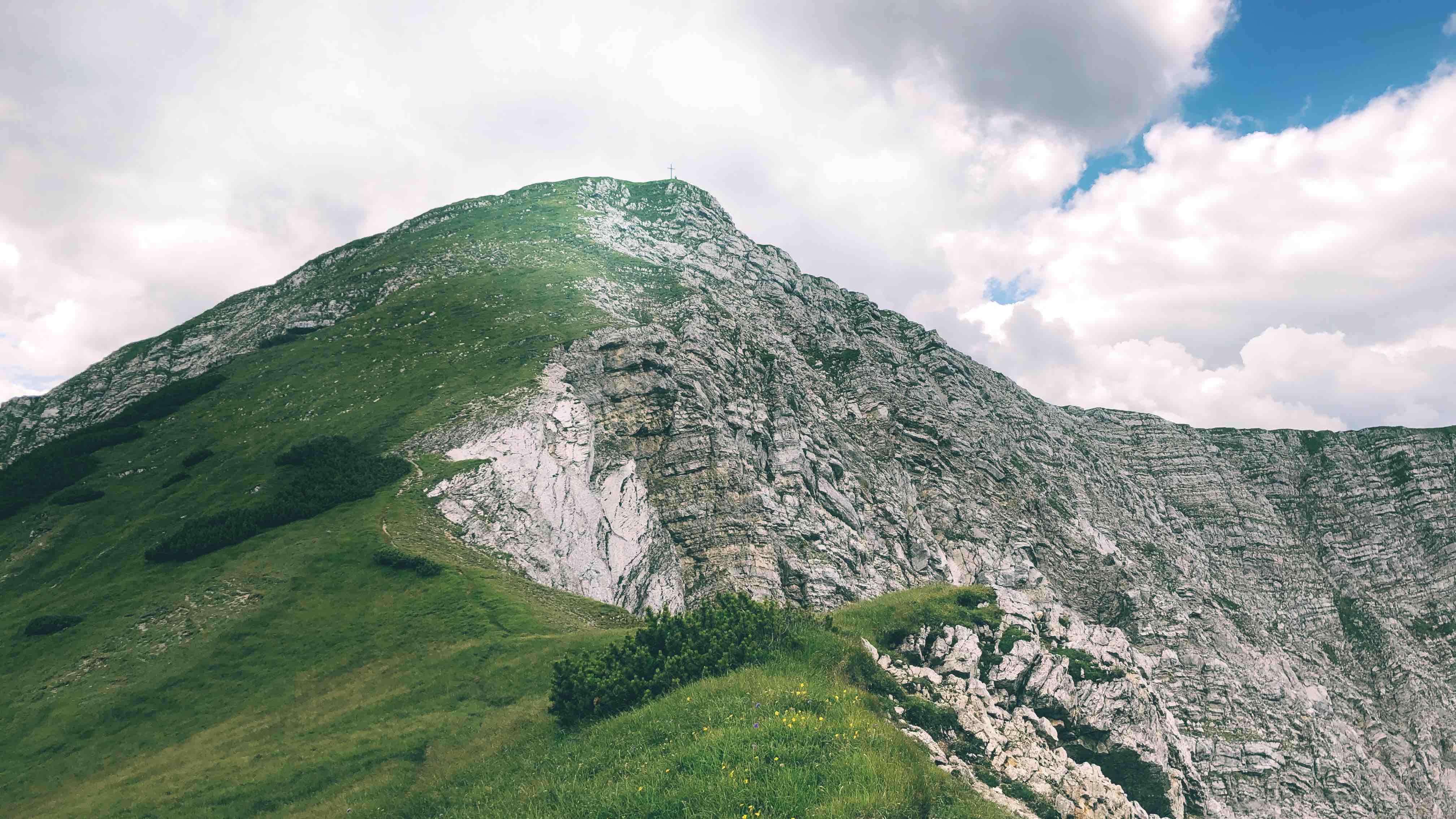
From the south is the Friederspitz (2049m) a gentle grassy mountain summit and probably the easiest 2000m high mountain in the Ammergauer Alpen. However, to the north-west does the mountain crash down 1000 m with a very complicated ground of cragged rock, and loose rocks. Thus, this side of the mountain is inaccessible. All routes to the top take the grassy hill side of the summit.
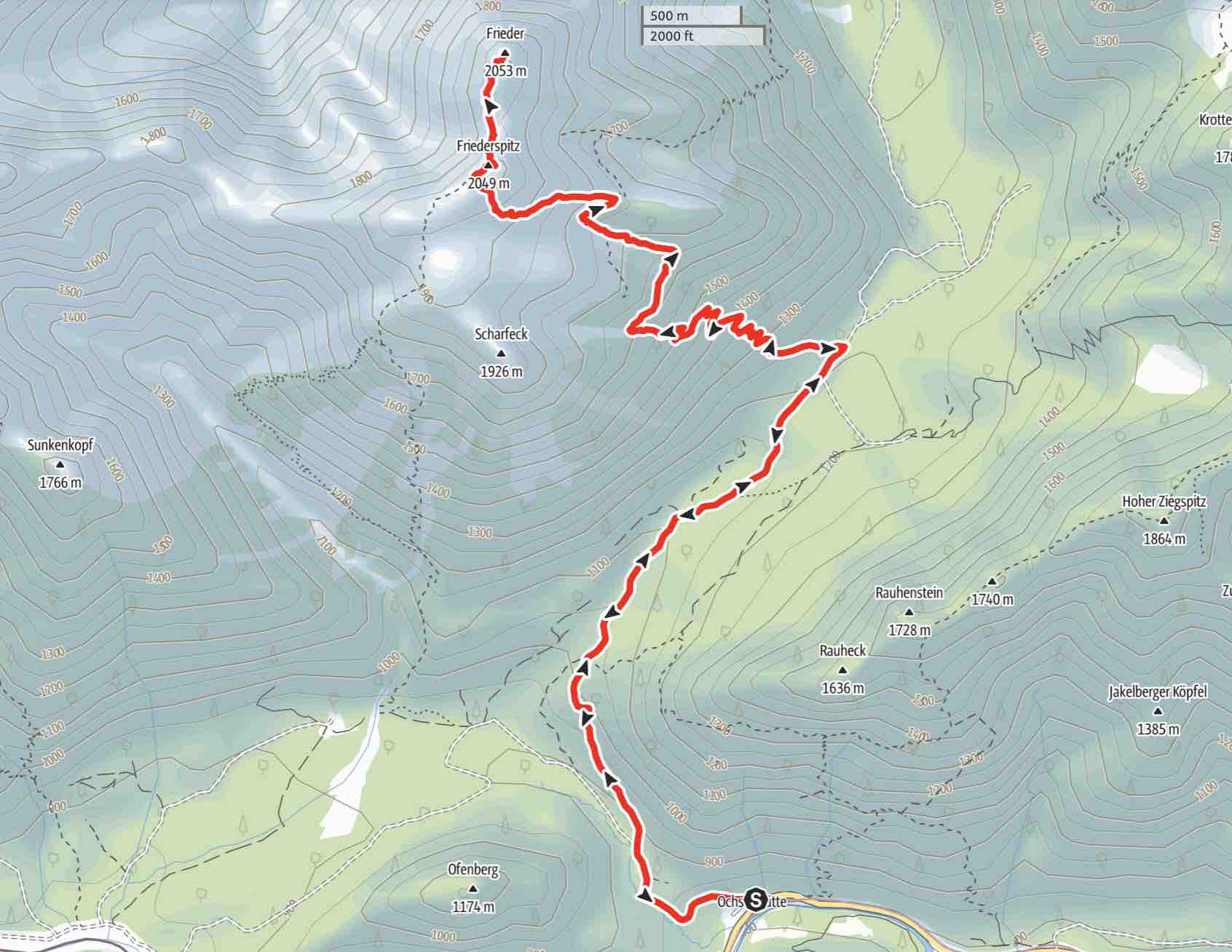
Route: Parking lot Ochsenhütte (ca. 800m) – Friederspitz (2049m) – optional: Frieder (2053m) - Descent same as Ascent; or loop via Friedergries, decent south-west trail from summit.
Map & Route Summary: online at alpenvereinaktiv
Character: The Friederspitz and Frieder is an easy hike on good paths. It never gehts very dangerous and no real risk of falling. However, it is a long hike and needs good fitness. (descent via south-west trail and Friedergries steeper)
Drive to base: Address for car navigation: Parkplatz Ochsenhütte, 82467, Garmisch-Partenkirchen. Parking lot is approx. 5km behind Garmisch and after the second railroad crossing parking lot on the right side of the road.
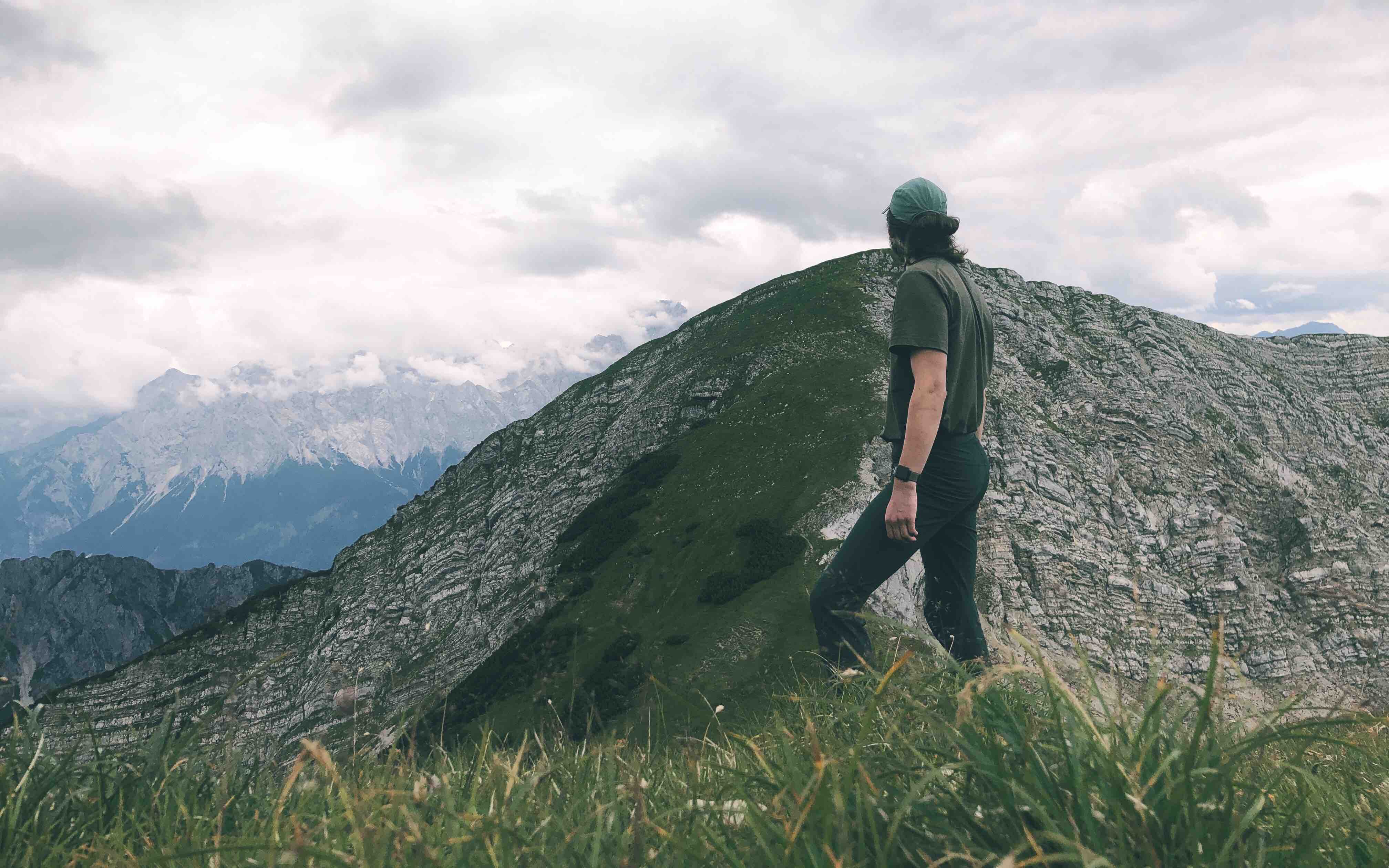
Hike: From the parking lot Ochsenhütte we follow the forest road to the direction “Friederspitz”. If you want to take the ascent via the south-west trail which is less steep, ignore the crossing sign that directs you left to the “Freidergries” – that is an alternative route. I usually ignore the sign and continue walking on the forest road. From the parking lot we walk for 4km on the forest road until we find a sign that directs us left to the “Friederspitze” into the forest. Then follow the trail in the forest. After maybe an hour you will find the “Friederalm”, a nice hut. There you follow the path on the left hand side of the hut. Finally you reach a grass hill, often with sheep, which leads to the summit cross of the Friederspitz. Form there you will have an incredible view to the Ammergauer Alpen, especially Kreuzspitze, as well as the Wettersteingebirge. For athletic hikers is the path to the Frieder summit very inviting. In total does to traverse to the Frieder summit and the way back to the Friederspitz add 200 m vert and takes approx. 1h. The path leads steeply down north to the direction of the Frieder summit. hike down and then back up on the visible trail to the Frieder summit. Descent is the same as the ascent.
Descent: The normal route for the descent is the same as the ascent. Or loop via Friedergries, decent south-west trail from summit.
Notes: Alternatively, you can ascent via the “Friedergries” and approach the summit of the Friederspitz from the south-west side. This path is a little steeper. If you choose this route, follow the first sign that directs you left to “Griesen” and “Friederspitz”.
Logbook:
Hike 25.07.2020 - Friederspitz & Frieder
 Route: Parking lot Ochsenhütte (ca. 800m) – Friederspitz (2049m) – optional: Frieder (2053m) - Descent same as Ascent; or loop via Friedergries, decent south-west trail from summit.
Map & Route Summary: online at alpenvereinaktiv
Description:
- (9:10am) I parked at the ‘Ochsenhütte’ Parking lot which is 5km behind Garmisch on the right hand side of the road.
- I hiked the normal and moderate trail first following the forest road for 4km and then taking a left turn into the forest following the sign to the Friederspitz.
- The trail was good and not difficult. It was a cloudy day and moderate temperature.
- It was a Saturday, which meant that there were more hikers than usually. Nevertheless, those is a hike you can do on busy day because it is not the most famous mountain.
- (11:35am) I reached the Friederspitz (2049m) summit.
- (12:00) I reached the Frieder summit (2053m).
- (14:50) I was back down again at the parking lot.
-
Tipp: 500 m before the parking lot is a bent in the forest road. At this bent you can see the ‘Schwarzenbach’. Hike down (no trail) to the ‘Schwarzenbach’ for a quiet spot and small waterfalls.
- In total I hiked from 9:10am to 3:00pm. Distance: 19.5km. Total elevation gain: 1.400hm. Highest point: 2.050m. Lowest Point: 804 m
