Hochplatte (2082m)
Ammergauer Alpen

| Details | |
|---|---|
| Type: | Medium mountaineering route (T3) |
| Ascent: | 3:00 h |
| Descent: | 2:00 h |
| Elevation: | 1000 hm vert. |
| Distance: | 10 km |
| Season: | End of May - Early October |
| Equipment: | Mountaineering boots (dt. Bergstiefel) |
| Notes: | Not recommended after snowfall or strong rainfall |
| Danger: | Alpine Environment with Alpine Dangers and exposed sections |
| Weather Forecast: | 1)wetter.com, 2)DAV-Bergwetter |
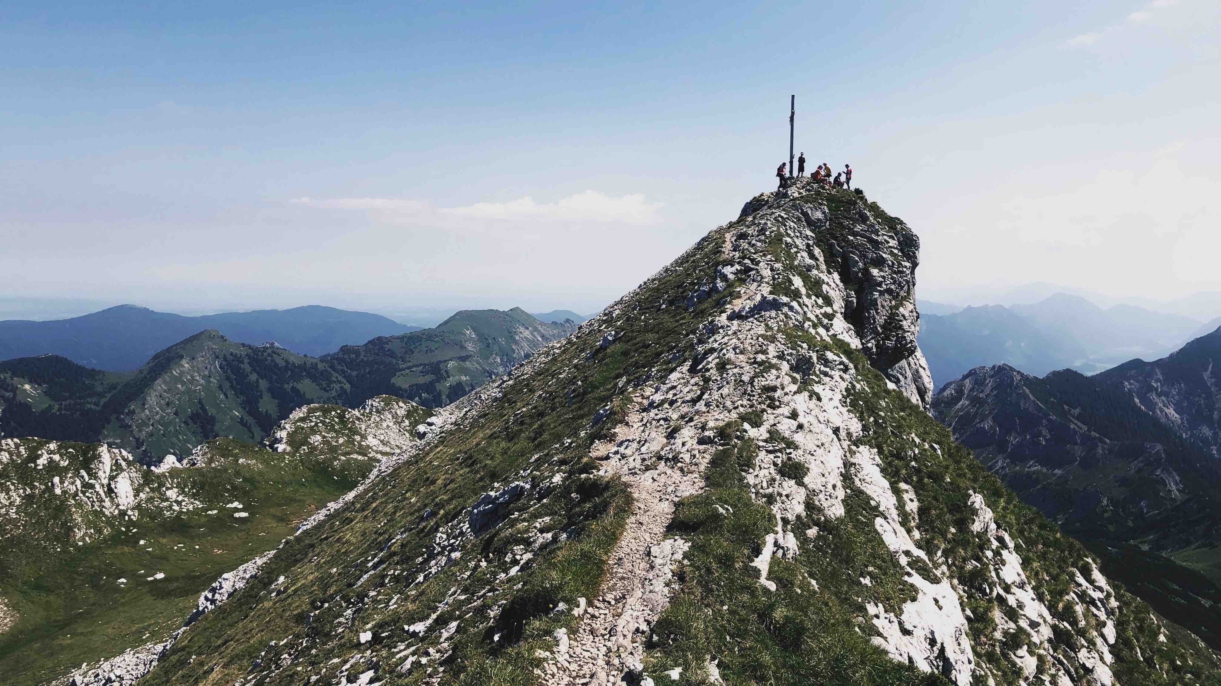
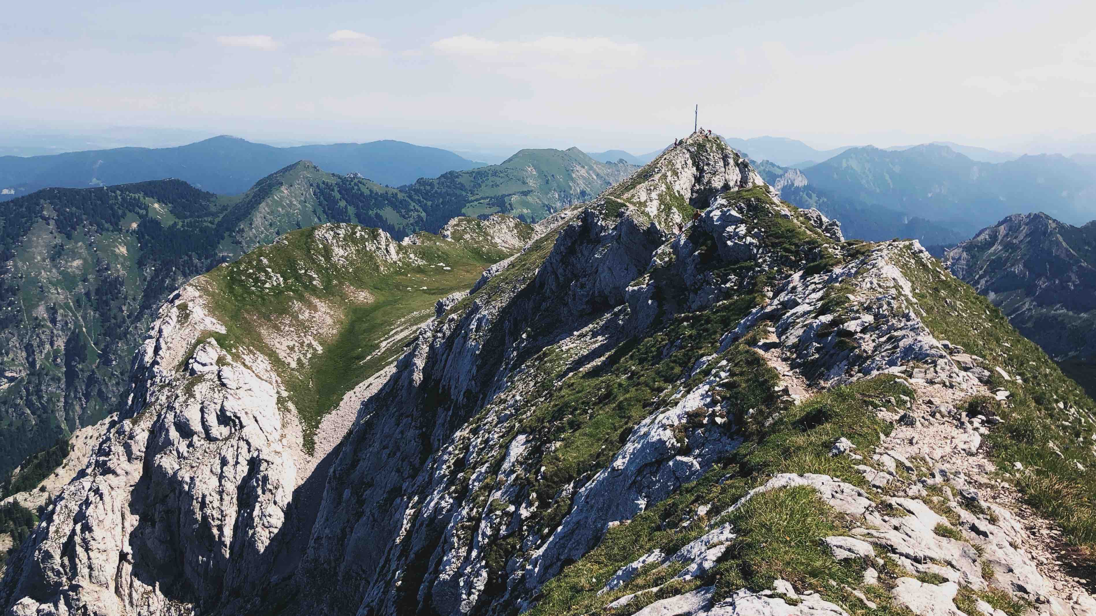
The Hochplatte (2082m) is the main summit of this part of the Ammergauer Alpen. It has a narrow ridge that invites for a beautiful ridge traverse. Many routes are possible to the Hochplatte e.g. from the Ammerwald alm, via Fensterl or Weitaljoch, or alternatively from the Kenzen and Kenzenhütte.
The hike to the Hochplatte is one of the most exciting and rewarding undertakings in the Ammergauer Alpen.
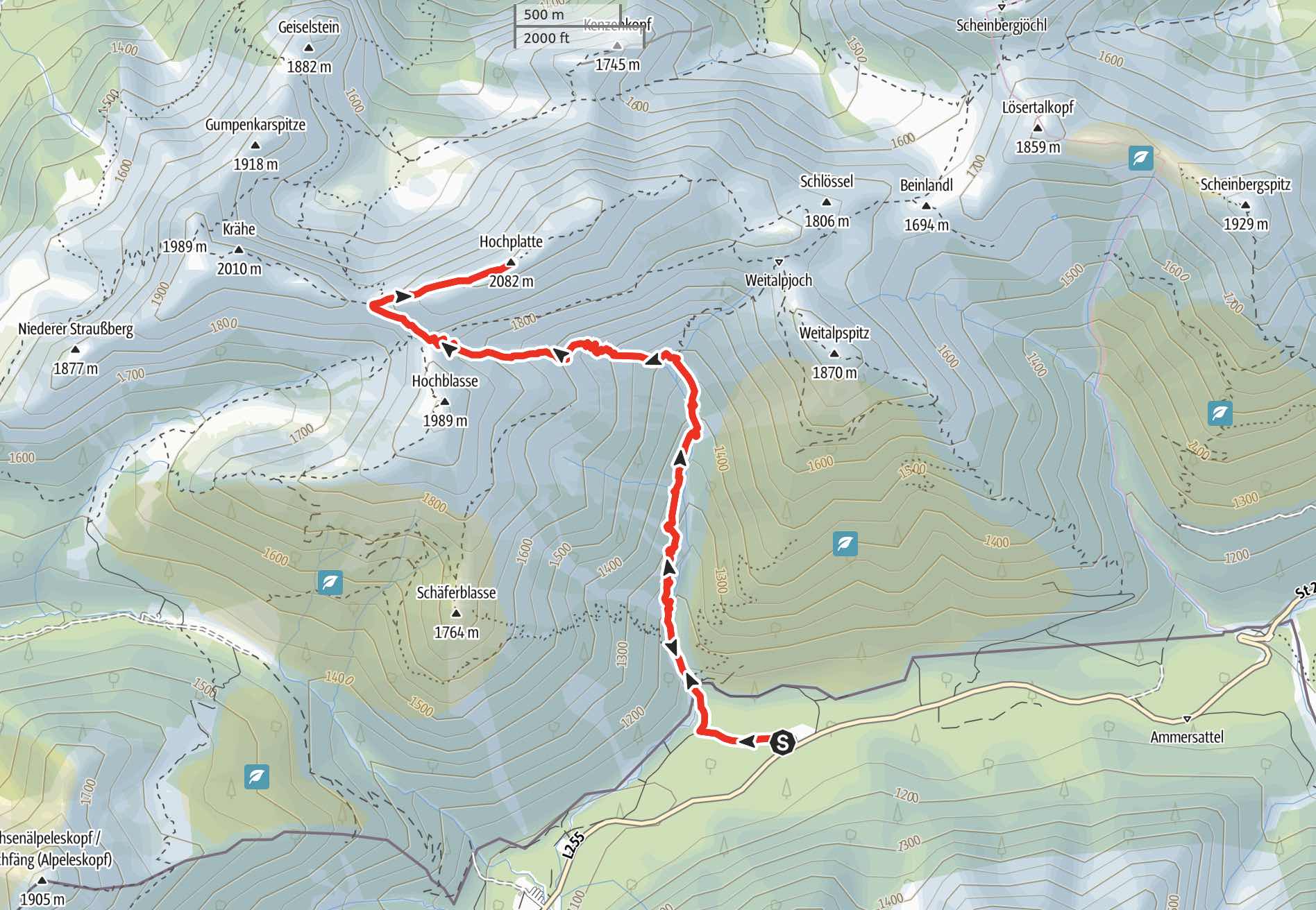
Route: Ammerwaldalm parking lot (1090hm) - Roggentalsattel (1883hm) - Fensterl (1916hm) - Hochplatte (2082hm) - Descent same as Ascent; or loop via Weitaljoch (1780hm) - Ammerwaldalm.
Map & Route Summary: online at alpenvereinaktiv
Character: The Hochplatte is an alpine mountaineering route of medium difficulty (T3). This hike requires experience and a good head for heights due to a few exposed sections. However, critical climbing sections are helped by fixed steel ropes.
Drive to base: Address for car navigation: Ammerwald, 6600 Reutte, Österreich. The parking lot is at the Ammerwald Alm, which lies approx. 3km behind the border.
Ascent: There are many routes that lead to the Hochplatte. My favourite starts from the parking lot of the Ammerwald Alm (1090m). From the parking lot we are walking left from the Alm and follow the path and signs to the ‘Hochplatte’ right in direction to the mountain stream. We follow the stream, which we have to cross after just a few minutes. We cross the river and follow the path up. (The mountain stream ‘Roggentalbach’ is inviting to cool your feet after completing the hike).
After approx 1h we reach a junction with yellow signs. Both directions left(west) and right (east) lead to the Hochplatte summit. The left path takes the route via ‘Fensterl’, and the right route via ‘Weitaljoch’.
I would take the more difficult and exposed route on the ascent, thus I take at the junction a left to the direction of the ‘Fensterl’. (Hikers who are less experienced or have fear of heights should perhaps take the easier route on the right and descent on the same route via ‘Weitaljoch’.)
Now we follow the steep path to the ‘Roggentalsattel’. The path leads through mountain pine (dt.’Latschen’) and then through the ‘Roggental-Kar’. The trail is nice and easy to hike on. We can see already the steep North-face of the Hochplatte.
We hike to the ‘Roggentalsattel’ (1883m) and then further to the ‘Fensterl’. At the ‘Fensterl’ (1916m) we find more signs leading to the many routes around us e.g. to the ‘Krähe’, wich is another rewarding summit additional to the Hochplatte or as easier alternative. We follow the sign to the right / east to the Hochplatte. Now we can follow the most enjoyable ridge to the summit. Just before the Summit we have to overcome a few very exposed climbing section, which, however, are helped with fixed steel ropes. This section shouldn’t be underestimated, is, however, very short. After the short climb we reach the impressive looking summit of the Hochplatte. The summit is often quite busy. Since many routes lead up to the Hochplatte the summit is often busy although the hike on the diverse routes are often relatively quiet.
Descent: You can either descent on the same route as the ascent, or do a loop e.g. Ammerwaldalm - Fensterl - Hochplatte - Weitaljoch - Ammerwaldalm (1090hm5h).
Direction of the loop can be freely chosen. However, the ridge section from the Fensterl to the Hochplatte summit it technically more difficult and more exposed than the ascent form the east, i.e. Weitaljoch to Summit is the easier route.
Notes: The Hochplatte is a very rewarding hike in the Ammergauer Alpen. The hike form the Ammerwald alm is diverse and not too long, with short sections of climbing and beautiful views. The hike to the Hochplatte can be extended by choosing one of the many surrounding summits e.g. Krähe (2010m), Weitalpsitz (1870m), or Hochblasse (1989m).
The hike from the Ammerwaldalm to the Hochplatte is almost always in the direct sun.
I recommended proper mountaineering boots (dt. Bergschuhe) for this hike due to a lot of big gravel, and the short climbing sections.
Logbook:
Hike 31.10.2020 - Hochplatte
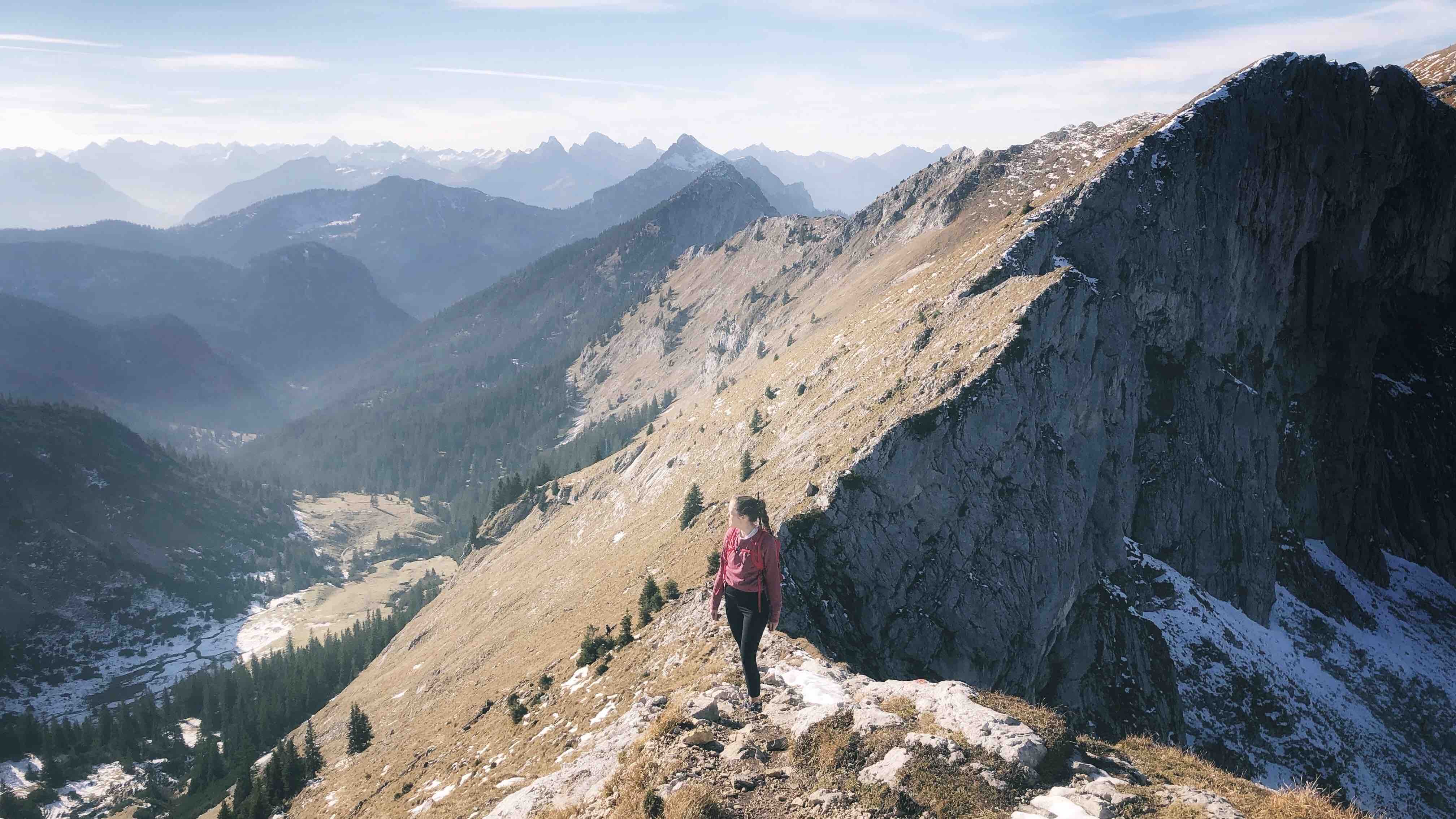
A wonderful end-October hike with Lauren. It was relatively warm and sunny. Snow was only an issue at short sections that were mostly in the shade, or on the ridge at the top. Due to wet stone and a bit of snow we decided against going all the way to the cross of the east summit and stayed at the summit plateau.
Route: Ammerwaldalm parking lot (1090m) - Roggentalsattel (1883m) - Fensterl (1916m) - Hochplatte (2082m) - Descent same as Ascent
Description:
- We parked at the Ammerwald alm parking lot.
- 11:00am: we started hiking; We were able to start that late since it was a nice Autumn day. Usually I would recommend starting earlier.
- 13:10: we reached the Fensterl.
- 13:40: we took a break at the summit plateau. (We did not climb all the way to the east summit cross, due to a lot of snow. moreover, the summit was relatively busy)
- In total we hiked from 11:00 to 17:00pm. Distance: 14km. Total elevation: 1.090hm. Highest point: 2080m. Lowest Point: 1090m
- Note: We started relatively late since the weather was good and we hoped the sun would dry some of the rock. In general I would recommend starting earlier.
 Picture was taken on the 31.10.2020 - Lauren on the ridge to the Hochplatte
Hike 31.07.2020 - Hochplatte & Krähe
Route: Ammerwaldalm parking lot (1090m) - Roggentalsattel (1883m) - Fensterl (1916m) - Hochplatte (2082m) - Fensterl - Krähe (2010m) - Fensterl - Roggentalsattel - Ammerwaldalm
Description:
- I parked at the Ammerwald alm.
- 9.10am: I started hiking
- 10:10am: after 1h I reached the junction. Here I followed the signs west to the ‘Fensterl’
- It was a very hot day and the Roggental-kar and the direct sun was very hot and tiering.
- 11:15am: I reached the ‘Fenster’(1916m)
- I followed the signs to the right in the direction to the Hochplatte summit and climbing the beautiful ridge.
- 12:00: I reached the Summit cross after the short climbing section that are supported by fixed steel ropes.
- The summit was very busy with other hikers, which led me to descent quite quickly on the same route that I took up. I took a break shortly after the climbing sections at a quieter spot on the Hochplatte ridge.
- Once I reached the Fensterl, I decided to ascent the Krähe also.
- I followed the signs and the relatively easy trail to the Krähen summit.
- 13:00: I reached the summit cross of the Krähe (2010m)
- After a break and drying my socks I descended on my ascent route.
- I cooled my feet and arms at the stream ‘Roggentalbach’.
-
15:30pm: I was back at the car at the Ammerwaldam parking lot.
-
Note: It was a very hot end-of-July day with temperatures in the 30s degree celsius. The hike to the Hochplatte from the Ammerwaldalm is not the best for such hot days as the majority of the hike is in the direct sun.
- In total I hiked from 9:10am to 3:30pm. Distance: 14.42km. Total elevation: 1.090hm. Highest point: 2080m. Lowest Point: 1090m

