Lampenspitze (2508m)
Karwendel

| Details | |
|---|---|
| Type: | Medium mountaineering route and Via-Ferrata (T3) / (A/B)-(C) |
| Ascent: | 3:30 h |
| Descent: | 3:00 h |
| Elevation: | 1400 hm vert. |
| Distance: | 18 km total |
| Season: | End of May - Early October |
| Equipment: | Mountaineering boots (dt. Bergstiefel), full via-ferrata gear, Helmet! |
| Notes: | Not recommended after snowfall or strong rainfall |
| Danger: | Alpine Environment with Alpine Dangers and exposed sections, Rockfall ! |
| Weather Forecast: | 1)wetter.com, 2)DAV-Bergwetter |
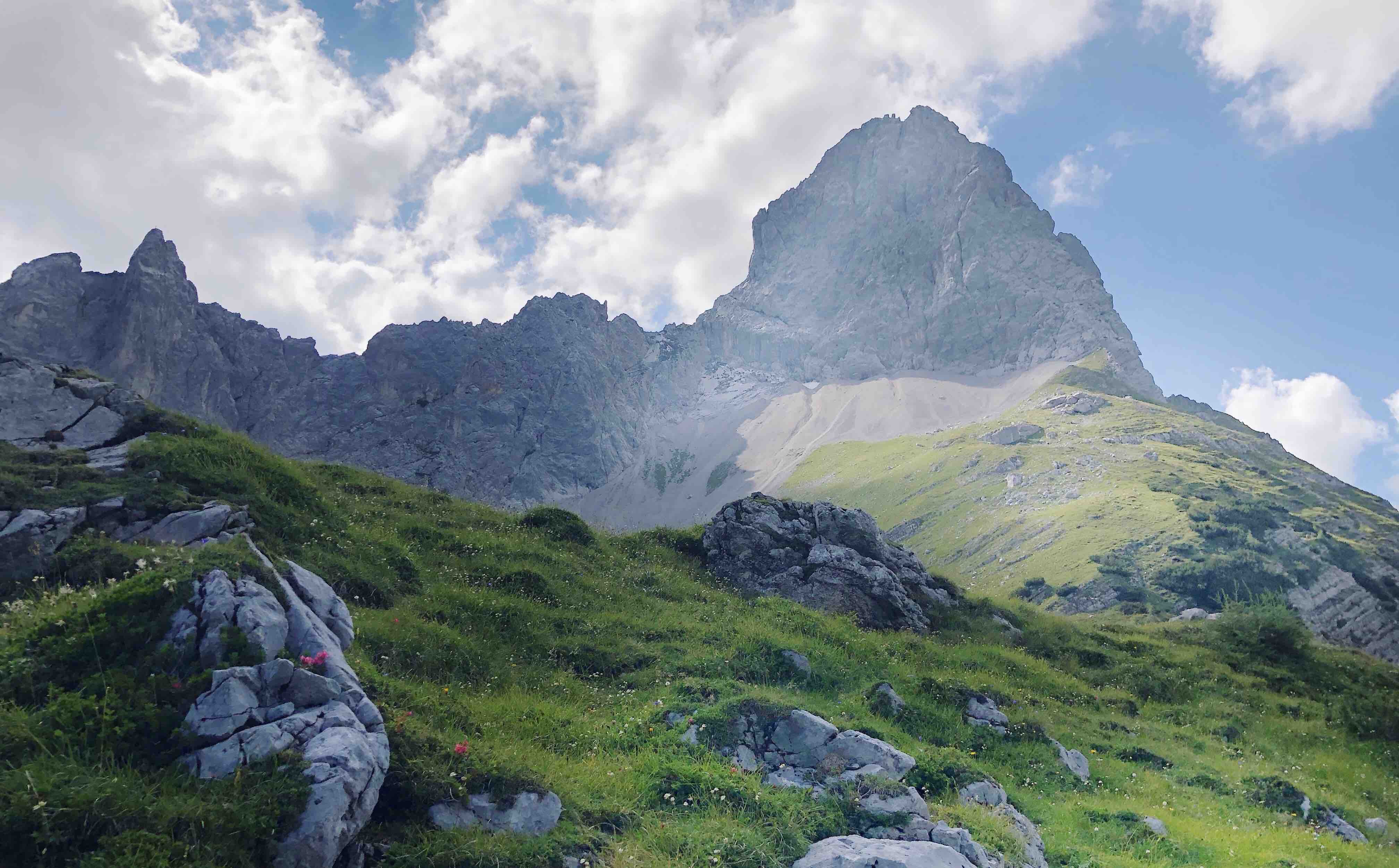
The Lamsenspitze (2508m) is a beautiful mountain in the Karwendel and a great summit for any alpinist and climber out there. Routes to the top include a Via-Ferrata or Alpine Climbing Routes. The summit rewards the exertion with an incredible view.
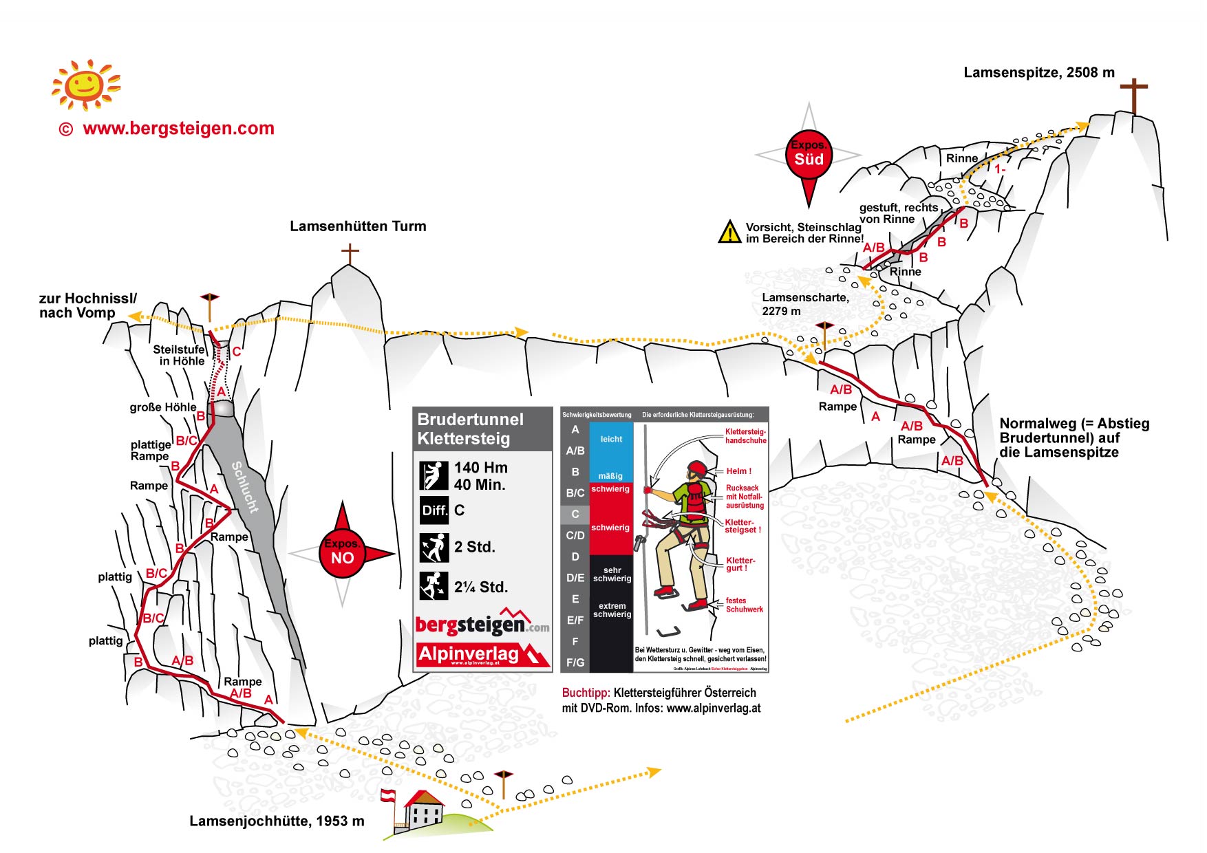
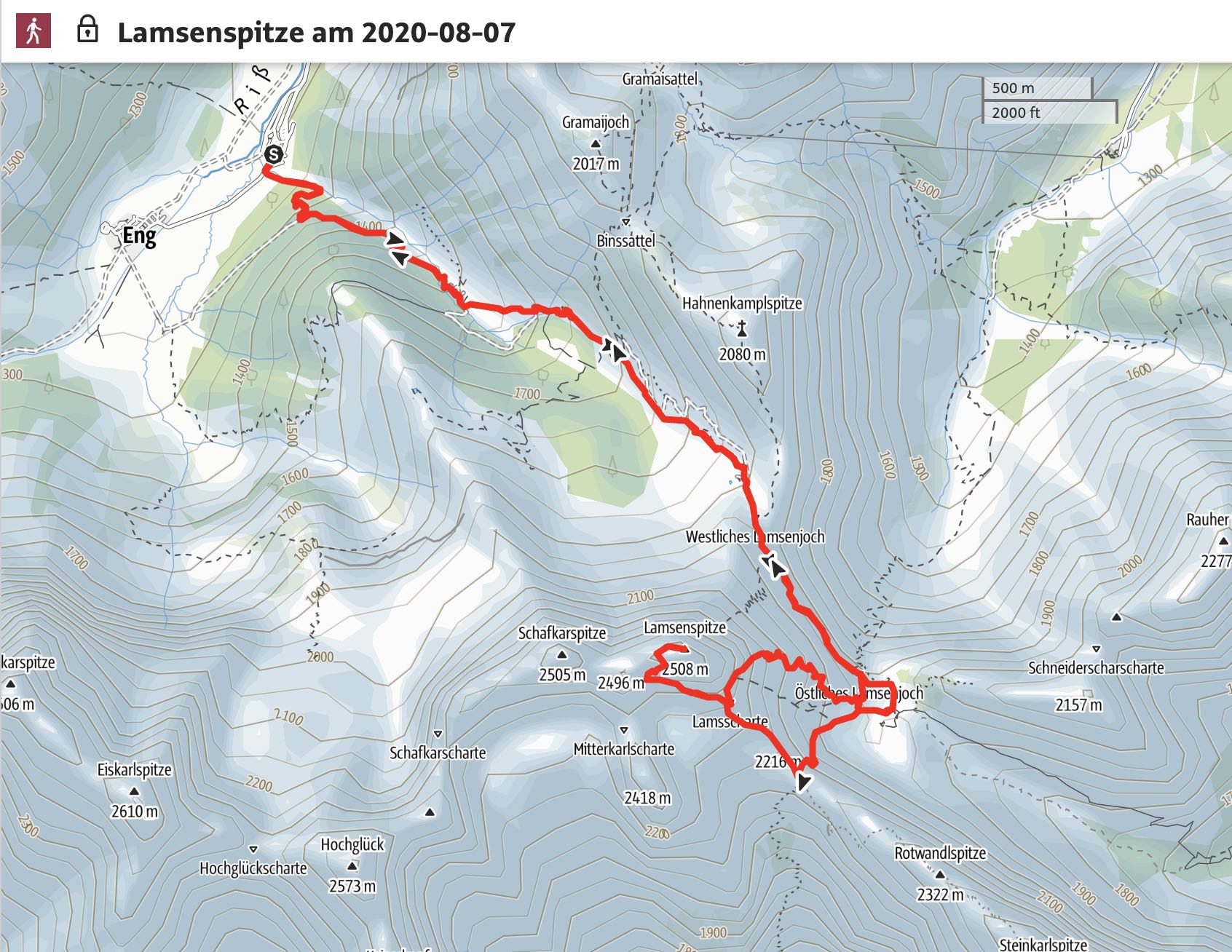
Route: Eng Hotel - Binsalm - Lamsenjoch – Lamsenjochhütte - Brudertunnel or Normalweg – Lamsscharte – Lamsenspitze (2508m) - Descent via Normalweg; rest same as ascent.
Map & Route Summary: online at alpenvereinaktiv
Video Description YouTube
Character: The Lamsenspitze is an alpine mountaineering route of medium difficulty (T3) with via ferrata sections 1) Normalweg (A-A/B), 2) Brudertunnel (B/C), and summit via-ferrata (B/C). Short sections to the summit without fixed rope (I).
This hike requires experience and a good head for heights due to exposed sections as well as experience in via-ferrata climbing.
Drive to base: Address for car navigation: Hinterriß-Eng 1-2, 6215 Hinterriß, Austria. The parking lot of the hotel ‘DIE ENG Alpengasthof und Naturhotel’.
Ascent: From the parking lot of the Alpengasthof Eng you follow the signs to the Binsalm. A steep path starts just left after the ‘Eng Alm’ Gate. After the Binsalm you follow a small path that leads up a mountain field. The direction is always the Lamsenjoch / Lamsenjochhuette. Once you reach the Lamsenjoch, an almost horizontal path leads to the Lamsenjoch Hütte. From here you can already see the hut in the distance.
From the hut you have two options: 1) either you take the ‘Normalweg’ which leads up on crushed rocks (i.e. dt. Schotterfeld) right to the bottom of the East face (Ostwand). You cross the bottom of the East face and then an easy via-ferrata (A-A/B) leads to the Lamsenscharte. 2) Alternatively, you can take the exciting and slightly more difficult via-ferrata route via Brudertunnel (B/C). Both routes lead to the Lamsenscharte. From there you follow the path on loose rock (dt Geröllfeld) in West direction until you reach the access point of the via-ferrata for the summit ascent (B-B/C). Be careful of rock falls. Note. the via-ferrata to the summit of the lamsenspitze has been redirected and is now slightly more difficult, however, less exposed to rockfall. Old guides and books will say this via-ferat is easy (A-A/B), however, since 2020 is the grade more a (B/C-C).
Descent: Descent as the same as the ascent. However, climbers who to the Brudertunnel Ferrata might want to take the Normalweg on the way down.

Logbook:
Hike 07.08.2020 - Lamsenspitze
Route: Eng Hotel - Binsalm - Lamsenjoch – Lamsenjochhütte - Brudertunnel – Lamsscharte – Lamsenspitze (2508m) - Descent via Normalweg; rest same as ascent.
Description:
- I parked at the Eng Hotel
- 10.10am: I started hiking
- 12:00: I reached the westliche Lamsenjoch
- 12:15pm: I am at the Lamsenjochhuette
- I took the Brudertunnel route. I was alone on the Ferrata. Porbbaly because I was quite late.
- 14:00: I reached the Summit cross after the short climbing section.
- The Hike so far was not very busy. I saw a few climbers coming down again. However I was the last to ascent.
- 17:00 I was back down at the parking lot of the Eng Hotel, where my parents and Bertie waited for my already.
- We cooled our feet in the river close to the parking lot with a fantastic view to the Spritzkarspitze.
-
A great day!
- In total I hiked from 10:10am to 17:00pm. Distance: 18 km. Total elevation: 1.390hm. Highest point: 2505m. Lowest Point: 1174m
