Zugspitze via Stopselzieher (2962m)
Wettersteingebirge

| Details | |
|---|---|
| Type: | Medium mountaineering route and Via-Ferrata (T3+) / (A/B) |
| Ascent: | 6:00 h |
| Descent: | 00:15 h with Cable Car |
| Elevation: | 1925 hm vert. |
| Distance: | approx 13 km |
| Season: | End of June - Early October ( route needs to be free of snow) |
| Equipment: | Mountaineering boots (dt. Bergstiefel), full via-ferrata gear, Helmet! |
| Notes: | Not recommended after snowfall or strong rainfall, or in early spring with left snowfields |
| Danger: | Alpine Environment with Alpine Dangers and exposed sections, Rockfall ! |
| Weather Forecast: | 1)wetter.com, 2)DAV-Bergwetter |
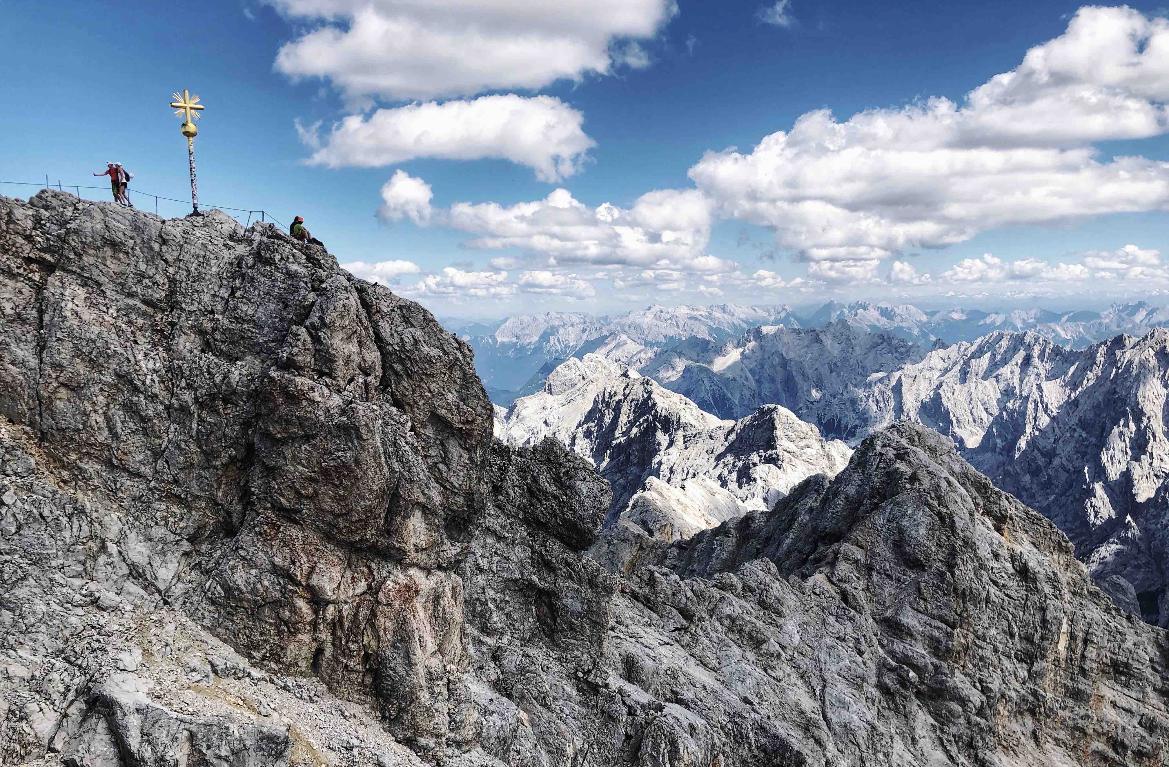
The Zugspitze (2508m) is the highest mountain in the Wettersteingebierge and the highest mountain of Germany. As the highest point in Germany and with many intersting routes, plus several cable cars and the famous Zugspitzbahn (Bavarian Zugspitze Railway)is the mountain and summit quite busy. Nevertheless, any route up to the almost 3000 m high mountain is worthwhile. The Zugspitzmassiv lies south of the town Garmisch-Partenkirchen and the Austria-Germany border runs over its west summit.
The Zugspitze was first climbed on 27 August 1820 by Josef Naus, Maier, and Johann Georg Tauschl. Today there are several routes to the summit: one from the Höllental valley to the northeast; another out of the Reintal valley to the southeast; one from the Ehrwalder Alm via the ‘Gatterl’, and one from the west over the Österreichische Schneekar and Stopselzieher. One of the best known ridge routes in the Eastern Alps runs along the knife-edged Jubiläumsgrat to the summit, linking the Zugspitze, the Hochblassen and the Alpspitze. For mountaineers there are a few huts. On the western summit of the Zugspitze itself is the Münchner Haus, on the western slopes is the Wiener-Neustädter Hut, and in the Höllental lies the Höllentalangerhütte.
To the summit run two cable cars: the Zugspitz-Seilbahn from the Eibsee and the Tiroler Zugspitzbahn from Ehrwald. Additionally runs the Bayerische Zugspitzbahn from Garmisch to the Zugspitzplatt.
This page descirbes the route to the Zugspitze from the Eibsee via Wiener-Neustädter Hütte, Österreichisches Schneekar, and Stopselzieher.
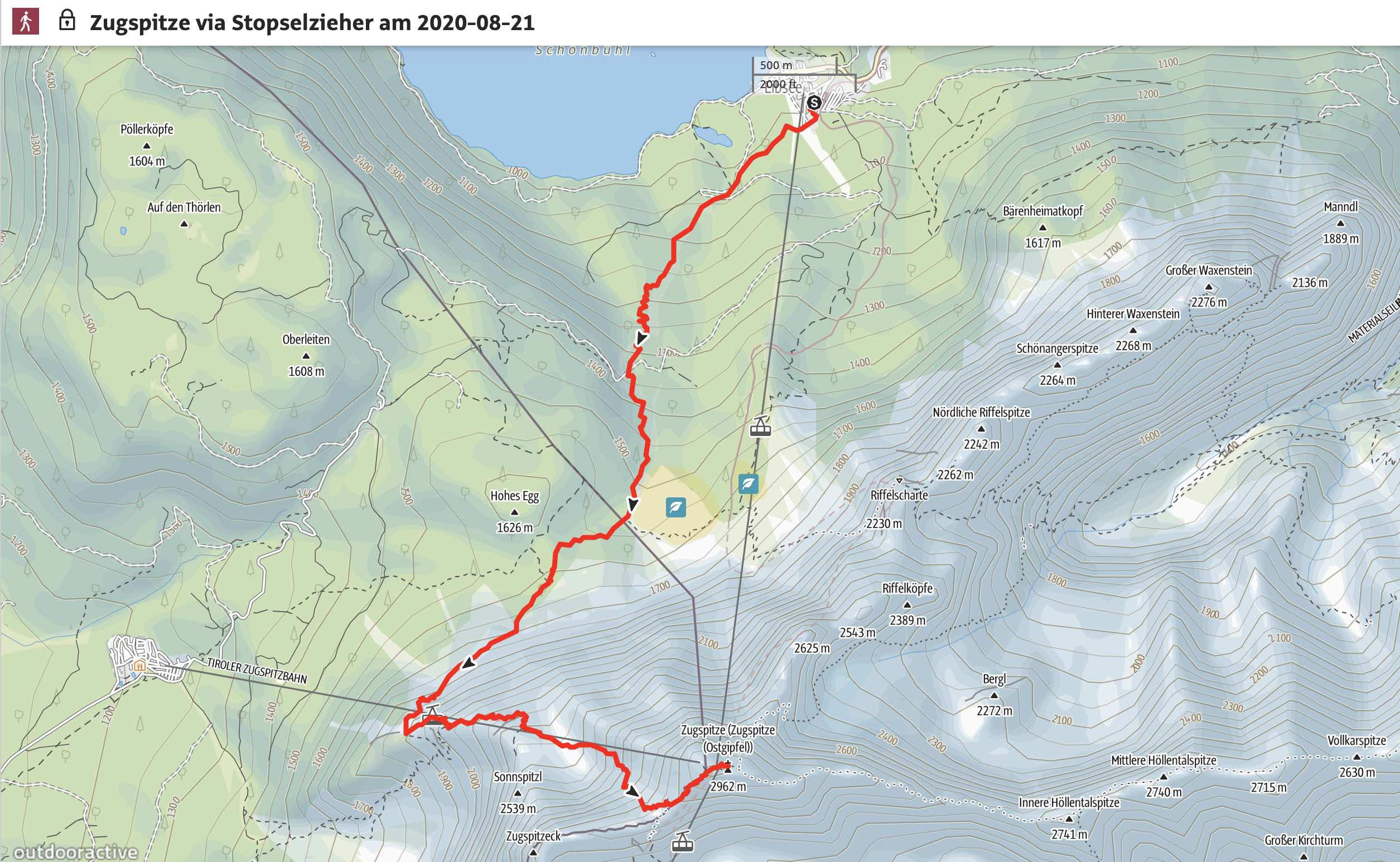
Route: Eibsee (950 m) - Wiener-Neustädter Hütte (2209 m)- Stopselzieher-Klettersteig – Münchner Haus (2962m) – Zugspitze (2962m) - (Cable Car ‘Zugspitz-Seilbahn’ back to the Eibsee)
Map & Route Summary: online at alpenvereinaktiv
Alpenverein Flyer Flyer_Sicher_auf_die_Zugspitze
Video Description [add link]
Character: The route to the Zugspitze via the Stopselzieher is an alpine mountaineering route of medium difficulty (T3+) with a via-ferrata section (A/B). The route should be only considered at good conditions, and in the summer when there is no snow on the route.
This hike requires alpine experience and a good head for heights due to exposed sections as well as experience in via-ferrata climbing.
Drive to base: Address for car navigation: Am Eibsee 1, D-82491 Grainau. The parking lot of the Eibsee Station of the Zugspitzbahn, or the Zugspitz Cable Car.
Ascent: From the parking lot of the Zugspitzbahn Eibsee Station you walk to the ‘Eibseealm’ and follow a forest road into the forest. Soon you will eacha crossing; follow the signs to “Zugspitzbahn Station Riffelriss“. First, we walk on the ski piste and then we follow a trail that is on the right of the ski slope. We follow this trail through the forrest uphill to the Bavarian-Tirolean border. Now we follow the signs to the right; direction to the “Wiener-Neustädter-Hütte” and to the “Zugspitzgipfel“.
The path gets steeper and we will reach soon first fixed steel ropes (which, however, can be followed without a via-ferrata set). We are gaining hight and the view is getting better and better.
The route to the hut is getting considerably more alpine and we have to master steep sections and loose grounds. finally, after approx. 4h you will reach the Wiener Neustädter Hütte (2209 m). From here you will have a great view to the entire Ammergauer Alpen and you will be able to see the old ‘Bergstation of the old Tiroler Seilbahn’. The hut is a great place to enjoy the view, take a long break, and check wether you have enough power and energy to master the last 750 m vert. via the via-ferrata to the summit of the Zugspitze.
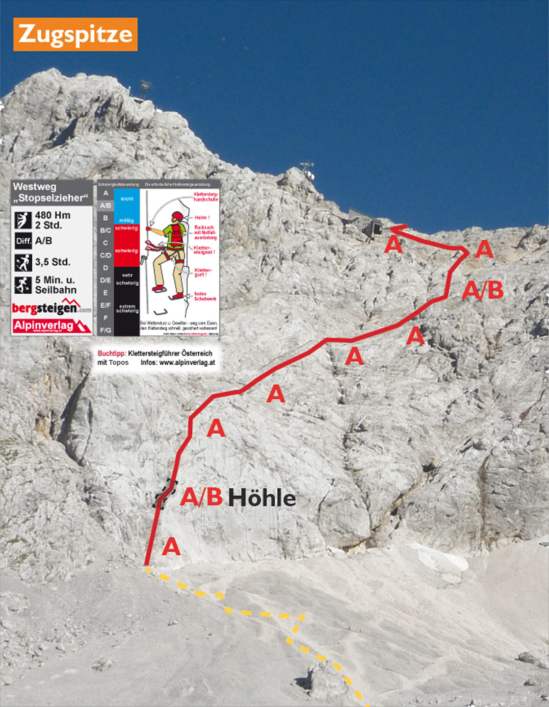
From the hut you will cross the ‘Geröllfeld’ (field of loose rocks), which has often until late summer snow. At the bottom of the wall (approx after 15 min from the hut) begins the via-ferrata. Here, or at the hut, you can put on the via-ferrata set and gear, helmet. The via-ferrata follows a logical route on the face and leads through a short tunnel. The route is sufficiently protected with fixed steel-ropes which makes the ascent easier. After approx 1:30h you will reach the ridge from where you can hike left to the Müncher Haus and the Zugspitz Bergstation as well as the Summit.
Descent: For most alpinists who want to do this tour in a day will take the cable car back down to the Eibsee parking lot. (tickets are 35,00 €, price in 2020).
Alpinists can also stay at the Müncher Haus over night and descent the next day on one of the several routes.

Logbook:
Hike 21.08.2020 - Zugspitze via Stopselzieher
Route: Eibsee (950 m) - Wiener-Neustädter Hütte (2209 m)- Stopselzieher-Klettersteig – Münchner Haus (2962m) – Zugspitze (2962m) - Cable Car ‘Zugspitz-Seilbahn’ back to the Eibsee
Description:
- I parked at the parking lot of the Seilbahn Eibsee Station
- 07:30am: I started hiking
- 10:50am: I reached the Wiener-Neustädter Hütte after approx 3.20h hiking
- I took a long break (approx 45 min)
- 13:50pm: I reached the Müncher Haus and the Summit shortly after
- There was such a long line at the summit that it took 30 min of waiting until I reached the cross.
- The platform and station on the Zugspitz summit was very busy even in corona times.
-
After enjoying the great view I took the cable car back down to the Eibsee parking lot.
- In total I hiked from 07:30am to 14:00pm when I reached the Summit. Distance: 13 km. Total elevation: 1900hm. Highest point: 2962m. Lowest Point: 950hm
