Hohe Munde (2662m)
Mieminger Kette

| Details | |
|---|---|
| Type: | Difficult Mountain Hike (T3) |
| Ascent: | 3.5-4.5h |
| Descent: | 3h |
| Elevation: | 1500 hm |
| Distance: | total 20km |
| Season: | June - October |
| Weather Forecast: | 1)wetter.com, 2)DAV-Bergwetter |
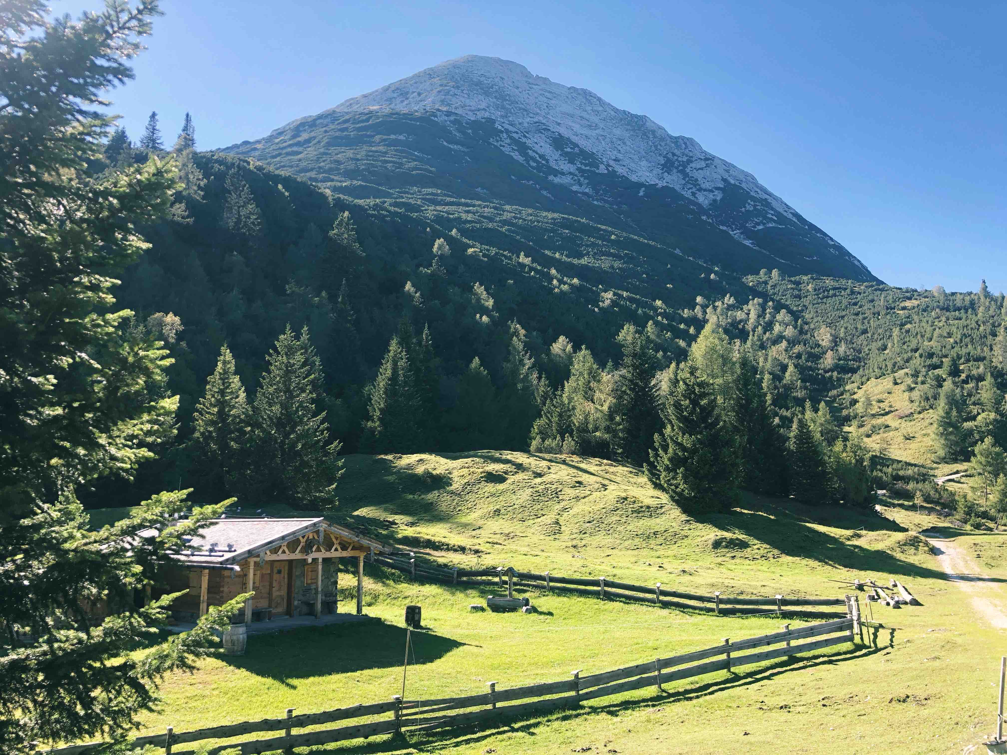
The Hohe Munde is a proud mountain at the eastern end of the Mieminger Kette (i.e. Mieming chain). It has two summits the East summit at 2592m and the west summit with 2662m. The Hohe Munde summit rewards the long hike with an incredible 360 degree view to e.g. the Wetterstein, Karwendel, and Inntal.
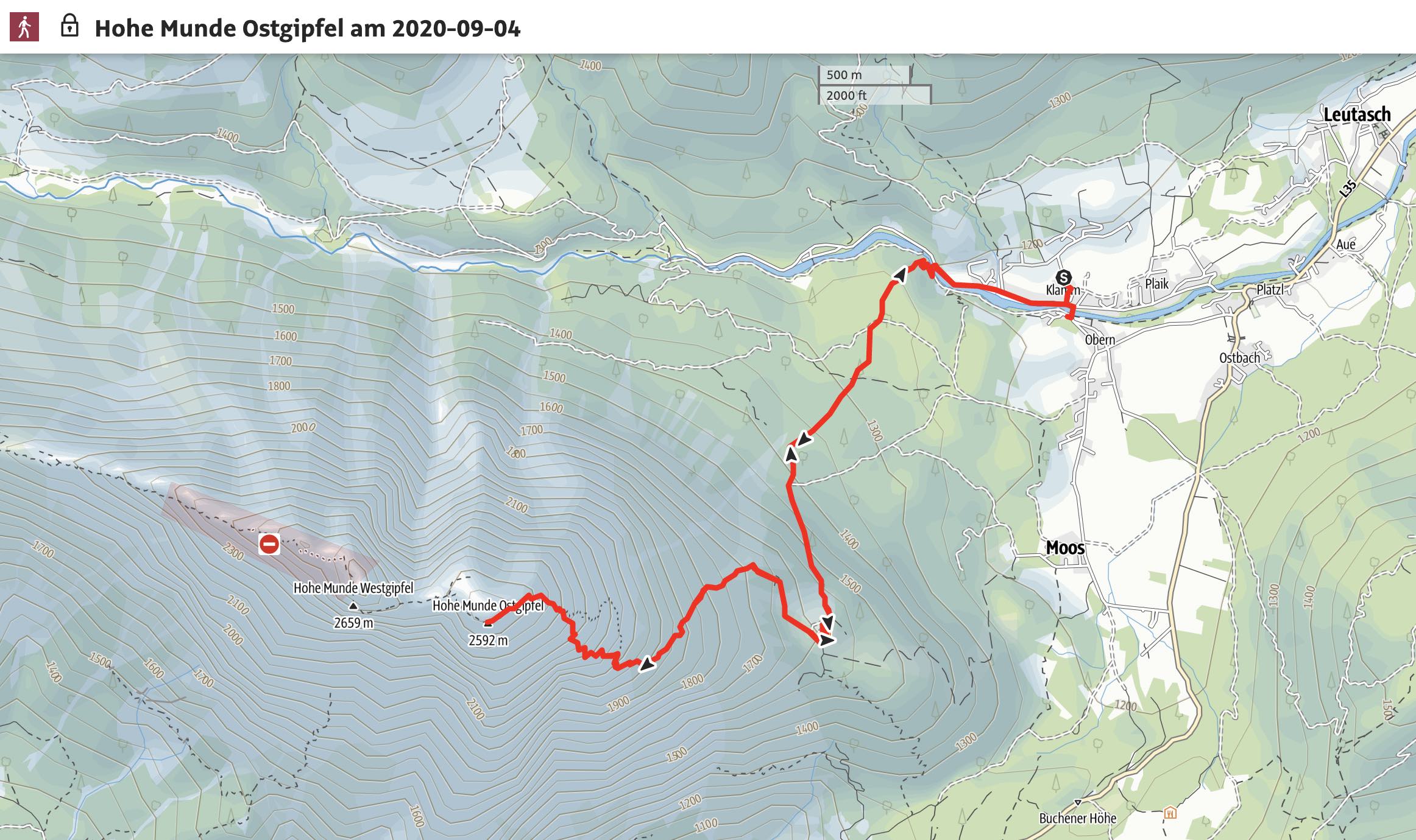
Route: Obern (1165hm) - Rauth Hütte (1605m) - Hohe Munde Ostgipfel (2529m) - Hohe Munde Westgipfel (2662m) - Descent same as Ascent
Map & Route Summary: online at alpenvereinaktiv
Video Description: YouTube: Hohe Munde 2592m
Attention - Danger! : Do not ascent or descent via the West ridge of the Hohe Munde as the Via Ferrata and trail called ‘Rauches Tal Weg’ is currently off-limits and closed by the alpine club due to serious landslides. The trail on the west side is since 2019 very dangerous and closed.
Character: The route to the Hohe Munde is a difficult mountain hike; maybe a (T3) or (T3-). The hike from Obern to the Rauth Hütte is easy and soon after we have to hike and scramble on steep fields and tracks. It is never really difficult and it is not really climbing but you want to use your hands for balance sometimes. There are not really exposed section with the exception of the ridge from the east summit over to the west summit.
Drive to base: Address for car navigation: Klamm, 6105, Austria. ; or 6105 Obern, Austria. I parked at a parking lot in Obern, which I think was called ‘Parkplatz Klamm’. It is a private parking lot by a local farmer. Any parking Space in Obern would do.
Ascent: The hike starts from Obern or Oberleutasch. First you hike through a nice spruce forest with the direction to the Rauth-Hütte. Which trail or forest road you take does not really matter as long as you make sure you reach the Rauth-Hütte. Once you reached the hut the path is pretty clear. The way in-front of us is still very long. A sign just behind the hut says it would take 3-3.5h to the summit. There is really just one trail that leads to the Hohe Munde and the directions are well indicated by red dots. Soon after the hut it gets significantly steeper with plenty of scramble sections. Although you will have to use your hands for balance it is never really difficult and not really exposed. Nevertheless, the hike is long and you will have to concentrate for the entire ascent as the scrambling can get exhausting. It might take you from the Hut to the East summit 2-3 hours. the East summit is a broad and big plateau with lots of space and a nice cross.
If you want to hike to the West summit you will have to hike down and back up again on a little exposed ridge. The ridge is a little exposed and you have to be careful with loose grounds. Nevertheless, the hike to the west summit is also not very difficult and lots more daunting than it actually is. I will take you about 30 min to get to the West summit. That means for your hike at least an extra hour of hiking and a few more meters vert. So make sure you have the time and the necessary energy.
Overall, the hike is very long and exhausting. You will need a good fitness. Moreover, the hike demands concentration for the majority of the time. You will have to focus on where you place your feet. Moreover, it can get pretty hot on the ascent as you leave the vegetation soon behind you and you will have the sun directly on you for the majority of the hike. Make sure you have sufficient sun projection and enough water with you.
The summit rewards the strenuous ascent with an incredible 360 degree view. You can see north the Wettersteingebierge, with the Zugspitze and Zugspitzplatt, all the way to the Leutascher Dreitorspitze. You will be able to see the Karwendelgebierge, and in the distant Stubai as well as mountains in Sellrain. Moreover, the view down to the Inntal is also impressive.
Descent: Descent same as Ascent. It might take you about 3h to get down.
Logbook:
Hike 04.09.2020 - Hohe Munde Ostgipfel
Route: Obern Parking Lot ‘Klamm’ (1165hm) - Rauth Hütte (1605m) - Hohe Munde Ostgipfel (2529m) - Descent same as Ascent
Description:
- I parked at a parking lot in Obern, which I think was called Obern Parking Lot ‘Klamm’. It is a private parking lot by a local farmer.
- 10:00am: I started hiking
- 11:00am: I reached the Rauth Hütte after approx 1h of hiking
- 13:20: I was on the East Summit of the Hohe Munde. It took me 3:30h.
- I took an hour break
- On the descent I saw a whole field of Edelweiss !
-
17:10 I was back down at the car.
- In total I hiked from 10:00am to 17:10pm. Distance: 20 km. Total elevation: 1500hm. Highest point: 2592m. Lowest Point: 1165hm
